
Clementi MRT Station
Clementi MRT Station (EW23) is a rapid transit station on the East-West Line in Singapore, featuring 4 exits: Exit A, Exit B, Exit C, Exit D. Use the interactive map to see every exit on the ground, or share your location to get walking directions to the exit closest to you.
All exits at Clementi MRT Station
- Exit A Open in Google Maps
- Exit B Open in Google Maps
- Exit C Open in Google Maps
- Exit D Open in Google Maps
MRT stations near Clementi
- Dover MRT Station 1.5 km
- Buona Vista MRT Station 3.0 km
- one-north MRT Station 3.0 km
- King Albert Park MRT Station 3.0 km
- Beauty World MRT Station 3.2 km
- Kent Ridge MRT Station 3.2 km
What's near Clementi MRT Station
Places whose closest MRT station is Clementi. Each page shows which exit to use and how far the walk is.
- Grantral Mall @ Clementi 50 m · 1 min walk
- The Clementi Mall 90 m · 2 min walk
- Clementi Public Library 130 m · 2 min walk
- Clementi Primary School 200 m · 3 min walk
- Clementi 321 240 m · 4 min walk
- Pei Tong Primary School 300 m · 5 min walk
- Clementi Town Secondary School 310 m · 5 min walk
- Clementi Sports Hall 360 m · 6 min walk
- Clementi Swimming Complex 420 m · 7 min walk
- Clementi Community Club 510 m · 8 min walk
- Firefly Park 550 m · 9 min walk
- Clementi Stadium 560 m · 9 min walk
Browse every place by nearest MRT station ›
Station coordinates: 1.315161, 103.765206. Exit positions are sourced from LTA open data.
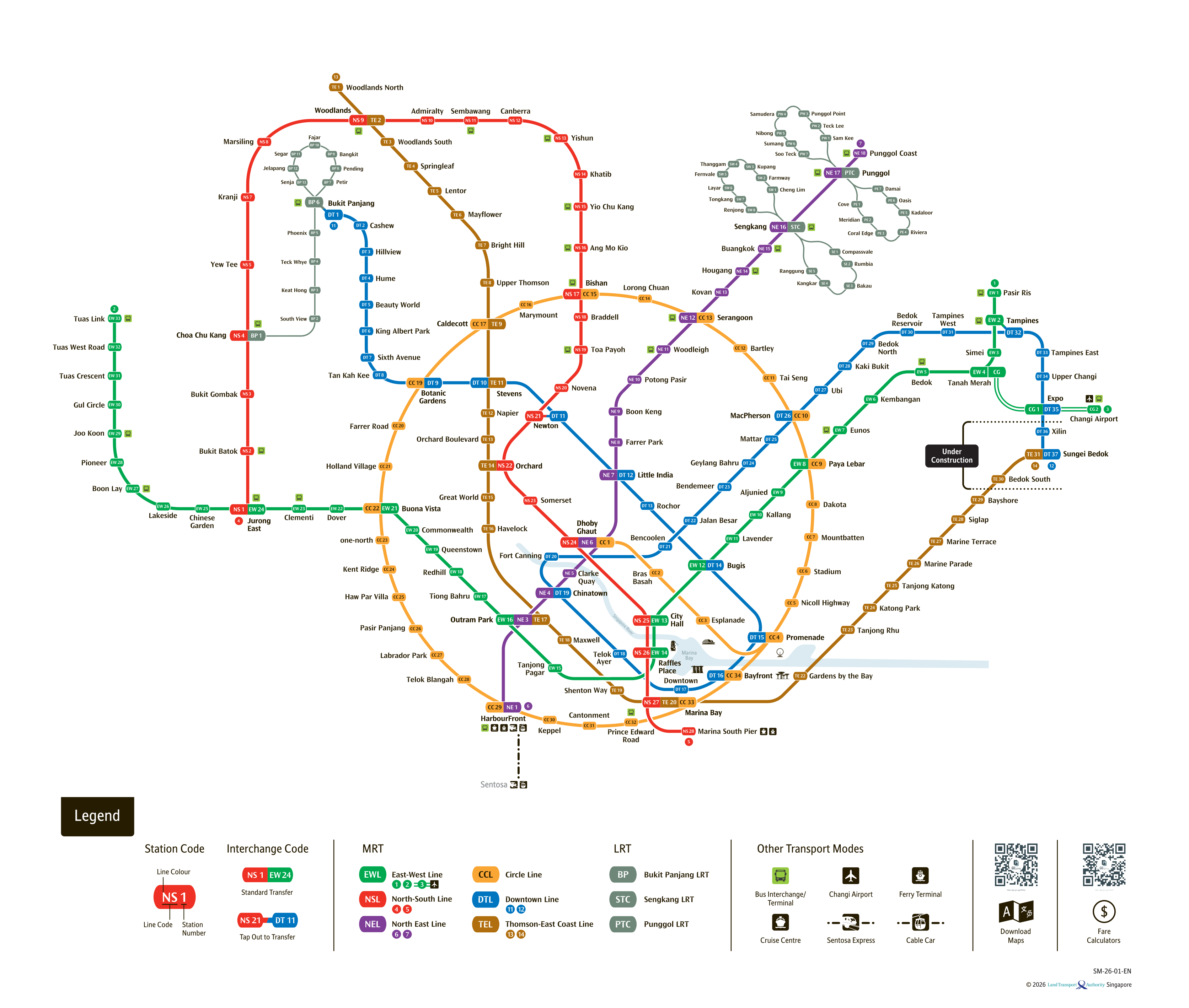
See the full Singapore MRT system map
All six lines and every station on one zoomable map — in English, 华文, Bahasa Melayu and தமிழ். Plan a route and fare between any two stations while you are there. Open the system mapFind the Nearest MRT Station to Your Location
Need the nearest MRT station right now? Click the button below to use your device's live GPS to instantly find the closest Singapore MRT station. We'll show you exactly which exit is closest to you and how to get there.