
Nearest MRT to Libraries in Singapore
All 41 libraries we hold data for, each with the MRT station closest to it. Open any one for the nearest exit, the walking distance, and alternative stations.
Place data © OpenStreetMap contributors. Station exit positions from LTA open data.
- Ang Mo Kio Public Library Ang Mo Kio
- Bedok Public Library Bedok
- Bishan Public Library Bishan
- Bukit Batok Public Library Bukit Batok
- Bukit Panjang Public Library Bukit Panjang
- C J Koh Law Library Botanic Gardens
- Casual Poet Library Tiong Bahru
- Cheng San Public Library Hougang
- Choa Chu Kang Public Library Choa Chu Kang
- Clementi Public Library Clementi
- Geylang East Public Library Aljunied
- Hon Sui Sen Memorial Library Kent Ridge
- Infant Library one-north
- ISEAS Library Kent Ridge
- Jurong Regional Library Jurong East
- Jurong West Library Boon Lay
- Kwa Geok Choo Law Library Bras Basah
- Lee Wee Nam Library Pioneer
- library@chinatown Chinatown
- library@harbourfront HarbourFront
- library@Orchard Somerset
- Lien Ying Chow Library Beauty World
- Marine Parade Public Library Marine Parade
- Medical Library Kent Ridge
- National Library Bugis
- Pasir Ris Public Library Pasir Ris
- Punggol Regional Library Punggol
- Queenstown Community Library Queenstown
- S.A.V.H. Library Caldecott
- Sembawang Public Library Sembawang
- Sengkang Public Library Sengkang
- Serangoon Public Library Serangoon
- Sheares Library Kent Ridge
- Sitorus Library Holland Village
- Sports Hub Library Stadium
- Tampines Regional Library Tampines
- Temasek Polytechnic Library Tampines West
- Toa Payoh Public Library Toa Payoh
- Woodlands Regional Library Woodlands
- Yale-NUS College Library Dover
- Yishun Public Library Yishun
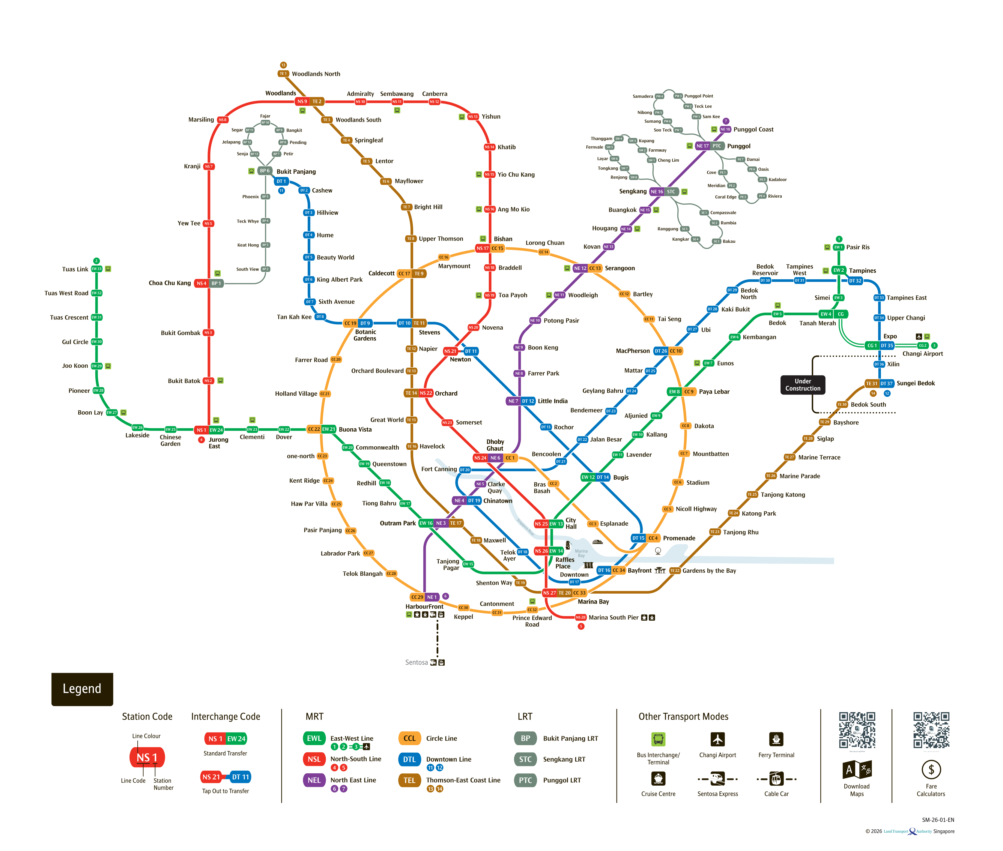
See the full Singapore MRT system map
All six lines and every station on one zoomable map — in English, 华文, Bahasa Melayu and தமிழ். Plan a route and fare between any two stations while you are there. Open the system mapFind the Nearest MRT Station to Your Location
Need the nearest MRT station right now? Click the button below to use your device's live GPS to instantly find the closest Singapore MRT station. We'll show you exactly which exit is closest to you and how to get there.