
Tan Kah Kee MRT Station
Tan Kah Kee MRT Station (DT8) is a rapid transit station on the Downtown Line in Singapore, featuring 2 exits: Exit A, Exit B. Use the interactive map to see every exit on the ground, or share your location to get walking directions to the exit closest to you.
All exits at Tan Kah Kee MRT Station
- Exit A Open in Google Maps
- Exit B Open in Google Maps
MRT stations near Tan Kah Kee
- Botanic Gardens MRT Station 860 m
- Farrer Road MRT Station 910 m
- Sixth Avenue MRT Station 1.4 km
- Holland Village MRT Station 2.1 km
- Stevens MRT Station 2.1 km
- Napier MRT Station 2.5 km
What's near Tan Kah Kee MRT Station
Places whose closest MRT station is Tan Kah Kee. Each page shows which exit to use and how far the walk is.
- Bougainvillea Park 60 m · 1 min walk
- Poh Ming Tse Temple 220 m · 4 min walk
- Duchess Park 280 m · 5 min walk
- Coronation Shopping Plaza 300 m · 5 min walk
- Yokoshi Tomo no Kai 370 m · 6 min walk
- King's Arcade 400 m · 6 min walk
- Kuan Yin San Temple 400 m · 7 min walk
- Raffles Girls' Primary School 470 m · 8 min walk
- National Junior College 610 m · 10 min walk
- Hwa Chong International School 680 m · 11 min walk
- Aqueduct 1.3 km · 21 min walk
Station coordinates: 1.325607, 103.807918. Exit positions are sourced from LTA open data.
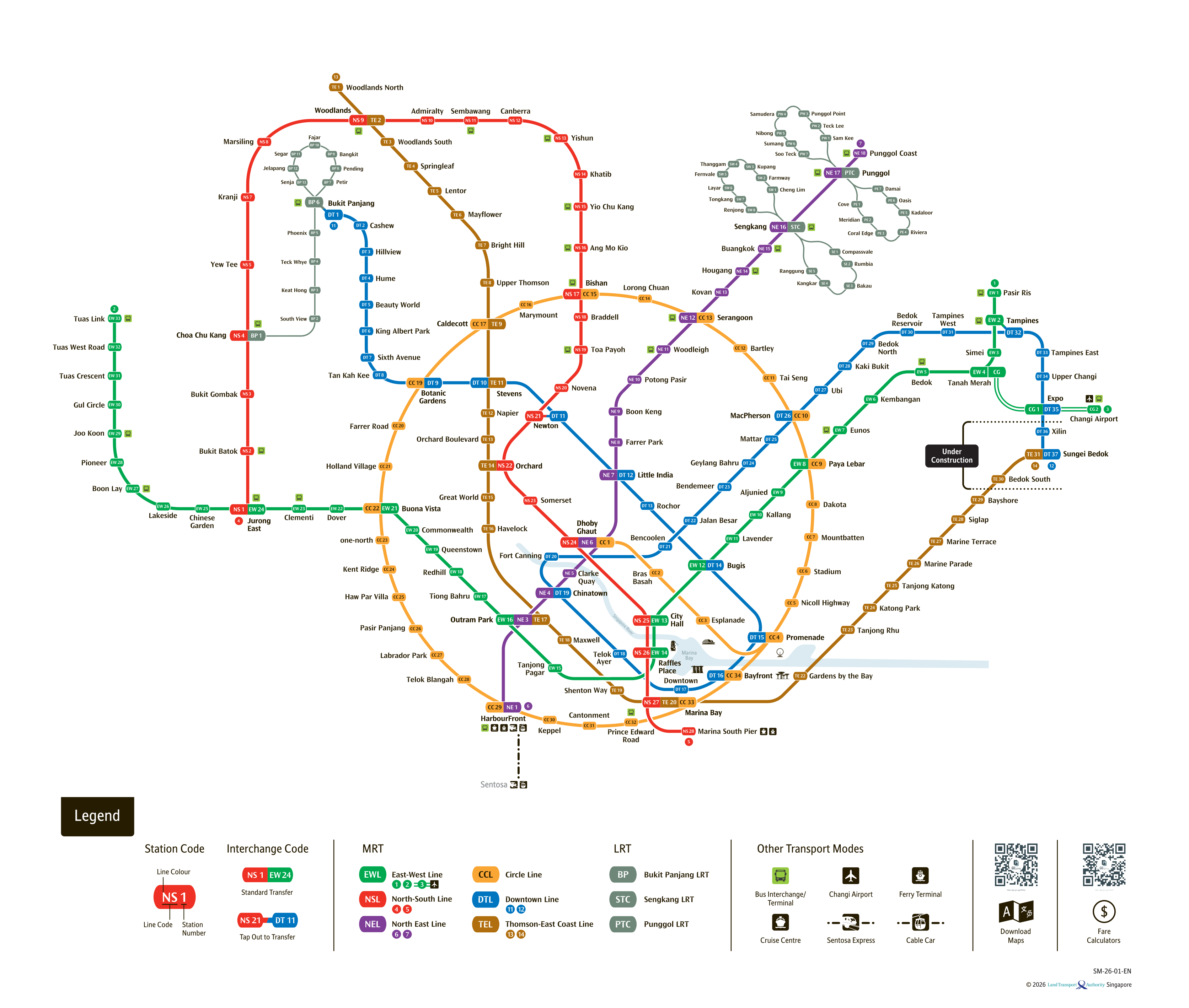
See the full Singapore MRT system map
All six lines and every station on one zoomable map — in English, 华文, Bahasa Melayu and தமிழ். Plan a route and fare between any two stations while you are there. Open the system mapFind the Nearest MRT Station to Your Location
Need the nearest MRT station right now? Click the button below to use your device's live GPS to instantly find the closest Singapore MRT station. We'll show you exactly which exit is closest to you and how to get there.