
Telok Ayer MRT Station
Telok Ayer MRT Station (DT18) is a rapid transit station on the Downtown Line in Singapore, featuring 5 exits: Exit A, Exit B, Exit C, Exit D, Exit E. Use the interactive map to see every exit on the ground, or share your location to get walking directions to the exit closest to you.
All exits at Telok Ayer MRT Station
- Exit A Open in Google Maps
- Exit B Open in Google Maps
- Exit C Open in Google Maps
- Exit D Open in Google Maps
- Exit E Open in Google Maps
MRT stations near Telok Ayer
- Raffles Place MRT Station 310 m
- Maxwell MRT Station 540 m
- Shenton Way MRT Station 550 m
- Downtown MRT Station 560 m
- Chinatown MRT Station 600 m
- Tanjong Pagar MRT Station 710 m
What's near Telok Ayer MRT Station
Places whose closest MRT station is Telok Ayer. Each page shows which exit to use and how far the walk is.
- The Clan Hotel (NOT in the Manulife Tower) 10 m · 1 min walk
- Fuk Tak Chi 40 m · 1 min walk
- Amoy Hotel 60 m · 1 min walk
- Nagore Durgha Indian Muslim Heritage Centre 90 m · 1 min walk
- Icon Link @ Club Street 90 m · 2 min walk
- Mercure ICON Singapore City Centre 100 m · 2 min walk
- Citikids Academy 110 m · 2 min walk
- Telok Ayer Green 110 m · 2 min walk
- Thian Hock Keng 150 m · 2 min walk
- Musical Box Museum 170 m · 3 min walk
- Al-Abrar Mosque 220 m · 4 min walk
- Yueh Hai Ching Temple 240 m · 4 min walk
Station coordinates: 1.282251, 103.848651. Exit positions are sourced from LTA open data.
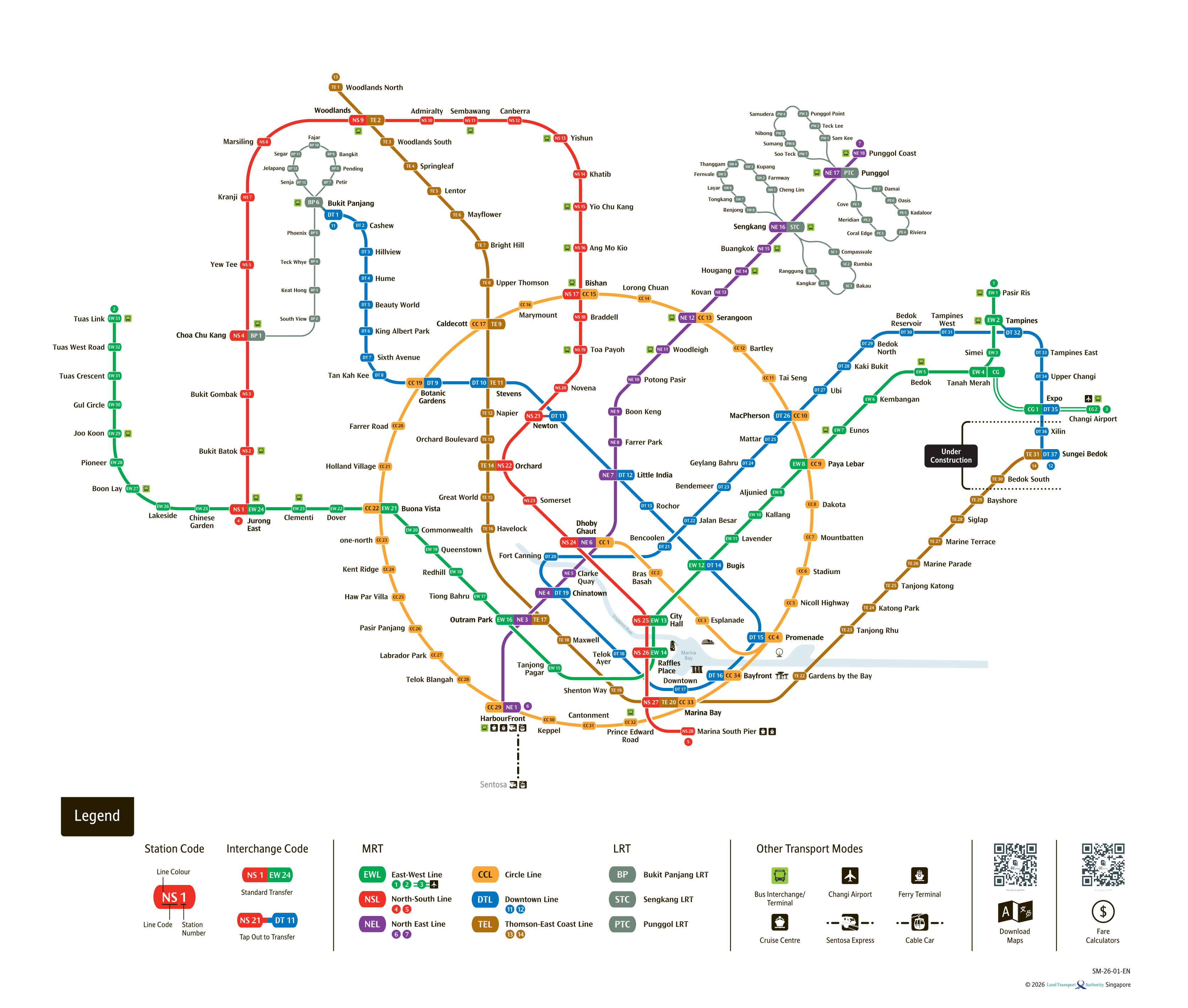
See the full Singapore MRT system map
All six lines and every station on one zoomable map — in English, 华文, Bahasa Melayu and தமிழ். Plan a route and fare between any two stations while you are there. Open the system mapFind the Nearest MRT Station to Your Location
Need the nearest MRT station right now? Click the button below to use your device's live GPS to instantly find the closest Singapore MRT station. We'll show you exactly which exit is closest to you and how to get there.